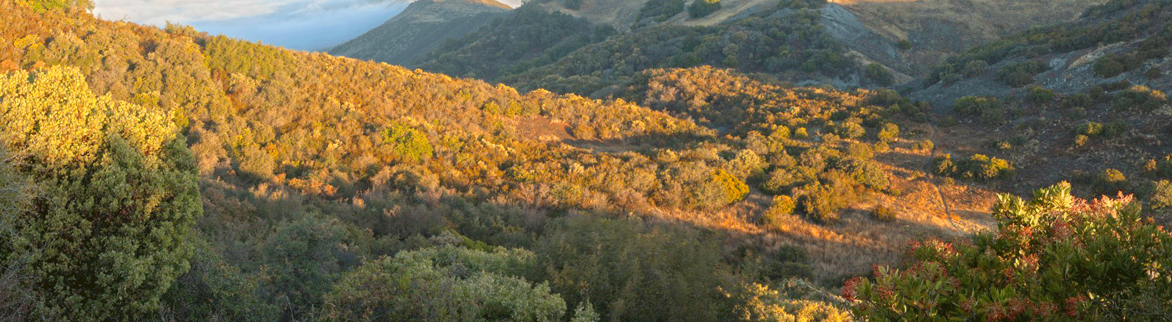
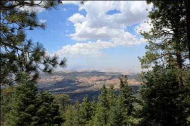
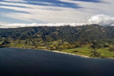
Los Padres National Forest, California’s second largest national forest, rises from the Pacific Ocean to over 8,800 feet in elevation and provides habitat for 468 species of wildlife, including the endangered California condor and the southern steelhead.
These public lands are invaluable resources providing:
• clean drinking water for communities
• watershed protection
• critical wildlife habitat
• cultural resource protection
• world class recreation opportunities
• water for agriculture
Check them out below...
Area Description
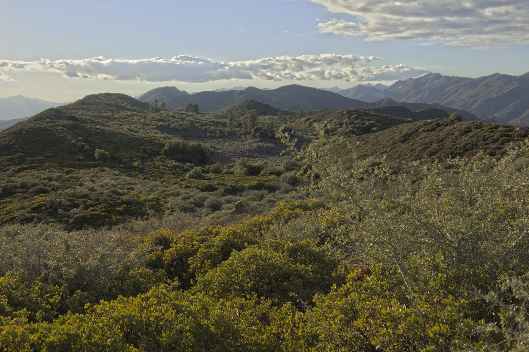
 This area is one of the few roadless areas in the region that includes oak savannah habitat, a once ubiquitous mixture of grasslands and oaks that is being rapidly destroyed by development throughout the state. Due to its habitat diversity, it may host the elusive San Joaquin kit fox and the San Joaquin pocket mouse, and it offers a refuge for mountain lions, badgers, California condor and a herd of wild horses. Three sensitive plant species are known to call the area home, and nine more species may exist there. The are encompasses the headwaters of the Salinas River which is an extremely important source of water for local communities, agriculture and wildlife. On clear days, visitors are treated to views of the far-off Sierra Nevada.
Total Size - 16,216 acres
Area Description
Chumash Additions © Michael Summers
Known as the "Bryce Canyon of California" because of its narrow, multicolored sandstone canyons, this area is home to pronghorn antelope, tule elk, San Joaquin kit fox, black bear, southern spotted owl and California condor. The proposed additions serve as a critical wildlife corridor between the Wind Wolves Preserve and the Chumash Wilderness. According to the Forest Service some portions of the badlands are known for their “considerable paleontological finds.”
Total Size -23,670 acres
Area Description
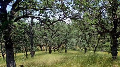 Beautiful oak woodlands and grasslands serve as important foraging habitat for raptors. The headwaters of the Salinas and Huasna Rivers originate along the flanks of Garcia Mountain. Many seasonal tributaries of the Salinas River have shady streamside groves of hardwoods. The area already serves as a condor foraging site, and its numerous erosion-caused caves, cavities, and ledges may once again serve as a nesting ground for the majestic bird. Golden eagles already nest there.
Total Size -7,289 acres
Area Description
 Striking red outcrops of rock, oak woodlands, seasonal wetlands, and small, shallow valleys make up this area. Groves of pine and fir grow in the higher elevations and many seasonal tributaries of the Salinas River have shady streamside woodlands. Condors forage in the area, and it is adjacent to a condor release site.
Total Size - 11,133 acres (of which 2,359 is potential wilderness)
Area Description
Santa Lucia Proposed Wilderness Area, Hi Mountain Unit
The area contains very fine oak woodlands and meadows that are being quickly developed elsewhere in the region. The area was a condor release site in the past and is foraging habitat for the condor today. The popular Rinconada trail traverses the area, providing great views of the surrounding mountains and valleys. Year-round streams flow through the area and visitors are treated to spectacular waterfalls.
Total Size -3,115 acres
Area Description
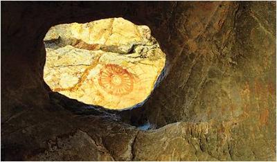
Chumash Pictographs in San Rafael Addition
Oak woodlands and grasslands offer critical foraging areas for deer, California condor and a number of other species. The Painted Rock area has a highly scenic waterfall. The proposed additions serve as an ecological staircase connecting valley grasslands with mid-elevation chaparral. Each step in the staircase contains an amazing diversity of plant communities, including occasional groves of pine and fir. The area’s many caves provide condor habitat and some of them are important archaeological sites. Some of these sites are included in the National Register of Historic Places. Native Americans continue to use the area for traditional cultural practices.
Total Size - 65,051 (of which 41,082 is potential wilderness)
Area Description
Condor Ridge © Bill Dewey
As its name implies, the area is historic habitat for the California condor. The south-flowing perennial streams in the area provide habitat for the endangered southern steelhead trout, while the perennial streams flowing both north and south are designated by the U.S. Fish and Wildlife Service as “critical habitat” for the threatened California red-legged frog. Habitat for the southern spotted owl is provided by forests gracing the area’s north-facing slopes. Visitors to the area are greeted by outstanding views in all directions, including the Pacific Ocean and the Coast Range.
Total Size -18,666 acres
Area Description
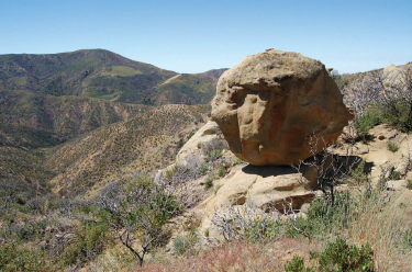
Balanced Rock © Gordon Johnson
The upper reaches of Buckhorn Creek flow year-round and host a healthy rainbow trout fishery. The area contains large, beautiful sandstone outcrops. The Mono Creek drainage offers towering canyon walls at a site called the Narrows, as well as deep pools of water and striking limestone outcrops. California spotted owls are suspected to nest in the area, and California red-legged frogs, southwestern willow flycatchers and one of the largest populations of southwestern pond turtles on the LPNF are also known to dwell there.
Total Size - 54,036 acres
Area Description
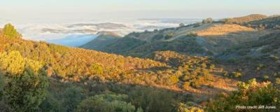
Diablo Caliente Additions Photo © Jeff Jones
The Diablo Caliente additions contain steep chaparral slopes, boulder-strewn creeks, and dense oak woodlands. These lands and rivers provide habitat for sixteen sensitive plant and animal species, including arroyo toad, California condor, California red-legged frog, California satintail, hoary bat, Ojai fritillary, pale-yellow layia and Palmer's mariposa-lily among others.
The additions also include Diablo Canyon, and Caliente Creek and Caliente Canyon.
The area shelters four relictual plant species that do not occur anywhere else in the region as well as prominent shale rock features, and the La Carpa Potreros at the upper reaches of Agua Caliente Canyon.
Total Size -17,870 Acres
Matilija additions Photo © Jeff Jones
The Matilija additions contain steep chaparral slopes, boulder-strewn creeks, dense oak woodlands, and expansive grasslands. These lands and rivers provide habitat for sixteen sensitive plant and animal species, including arroyo toad, California condor, California red-legged frog, California satintail, hoary bat, Ojai fritillary, pale-yellow layia and Palmer's mariposa-lily among others.
The additions also include the Dry Lakes Ridge Botanical Area designated by the Los Padres National Forest. The “Dry Lakes” are seasonal ponds that provide habitat for a diverse array of unique plant life. The area shelters four relictual plant species that do not occur anywhere else in the region as well as remnant groves of ponderosa pines. Perennial creeks flow through the area, including the North Fork of the Matilija proposed wild and scenic river.
Total Size -30,184 acres
Area Description
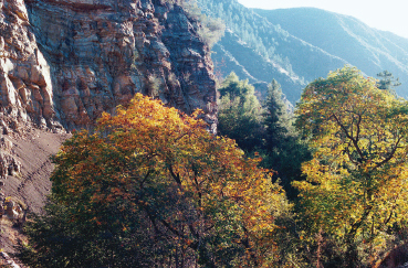
Fall Colors in Sespe Gorge © Jim Rose
Contains a startling variety of plant communities including forests of pine and fir, streamside forests of sycamore, willow and cottonwood, oak woodlands and chaparral. Santa Paula Canyon, which is adjacent to the area, is a popular hiking and swimming destination. Bluff Creek is known for its majestic cliffs. Topatopa Bluff is a tremendous scenic escarpment that can be seen for miles from the Ojai, Santa Clara, and Simi Valleys.
Total Size -14,313 acres
![]() The Condor Trail is a recreational thru-hiking route designed to connect the northern and southern portions of the Los Padres National Forest by a single hiking trail. The hiking/backpacking trail is approximately 400 miles long and extends from Lake Piru (border of Los Angeles and Ventura Counties) in the south to Botchers Gap (just south of Monterey, CA) in the north.
The Condor Trail is a recreational thru-hiking route designed to connect the northern and southern portions of the Los Padres National Forest by a single hiking trail. The hiking/backpacking trail is approximately 400 miles long and extends from Lake Piru (border of Los Angeles and Ventura Counties) in the south to Botchers Gap (just south of Monterey, CA) in the north.
Learn more about the Condor Trail here: http://www.condortrail.com/


